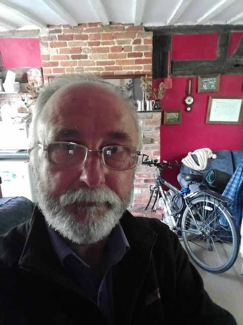
I promised to write up my journey partly to try to squeeze some more sponsorship out of people, but also because any such venture has bits that are fairly forgettable, and it would be a good idea to record them before I forget them myself.
Many thanks to those who have already sponsored me and also to those who will. If anyone who has not yet donated to my charities feels that any of my efforts are worth a few quid to charity, then please go to http://uk.virginmoneygiving.com/fundraiser-web/fundraiser/showFundraiserProfilePage.action?userUrl=AndySanderson or search for me on Virgin Money Giving, or you can hand me cash and I'll pass it on. I am supporting Cancer Research UK, Parkinson's UK, Essex and Herts Air Ambulance, Sustrans and the Alzheimer's Society.
So here goes.
Leading up to the tour, my European car insurance had run out and I had driven the car back to the UK, then flown out to Portugal for a few more days, for a party at my house on 29th April, intending to leave on or about 1st May. It seemed like a good idea at the time, but I knew I would have problems, and was not sure about my right shoulder, which I damaged in 2016 (probably loading the car) and my right knee which I also damaged in 2016 (probably by kneeling on some tool or other while fixing up the house). In the case of major problems I reckoned that I could get on a train or plane for the remainder of the journey.
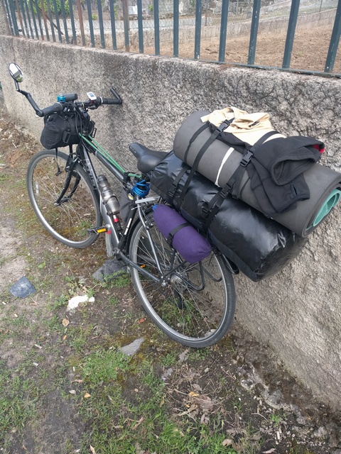
Unfortunately, my new and better bike was in the UK, so I was going to have to use an old one with 2750 miles on it already, and as it turned out, it wasn't really up to the job. This bike had made it to Scotland from Essex in 2012, had a fairly new rear wheel and metal pedals, but other than that was more or less as it came out of the shop. All £200 worth of it. I didn't have a lot of opportunity to service it properly before I left, nor to get fit for the trip.
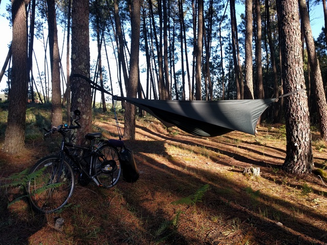
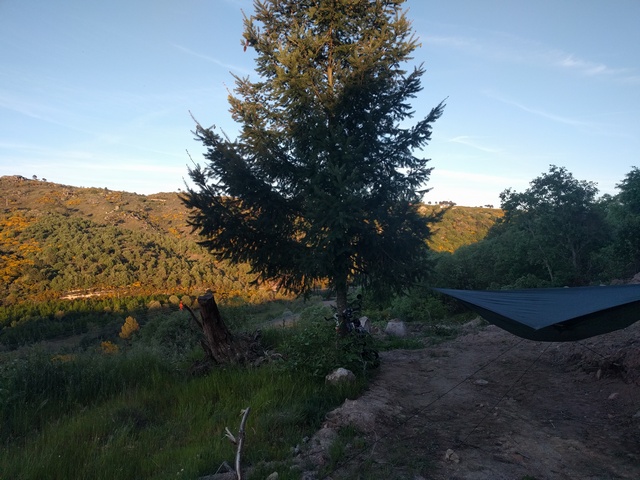
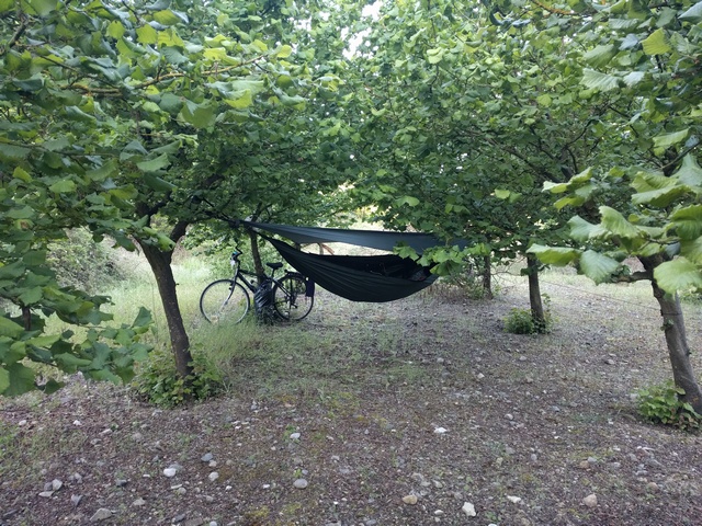
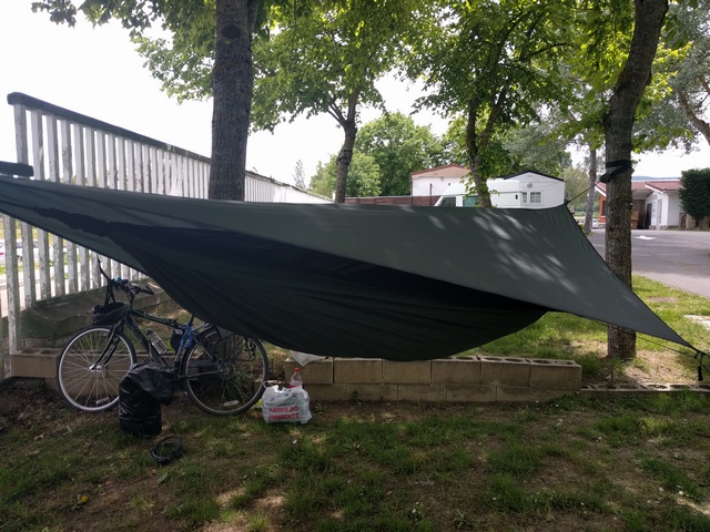
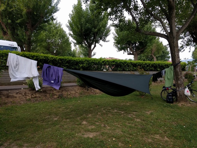
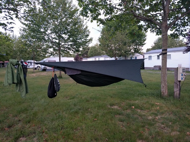
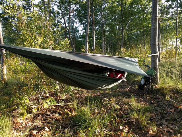
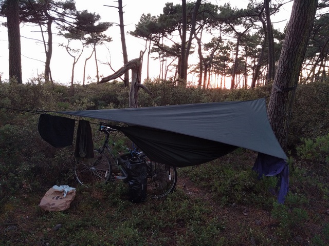
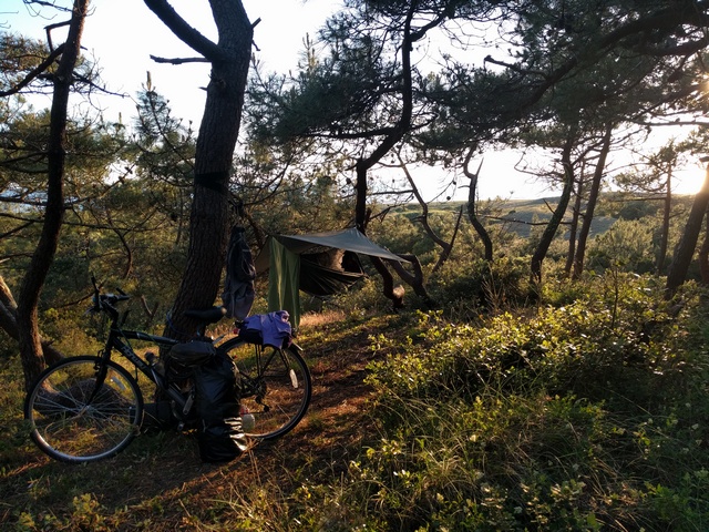
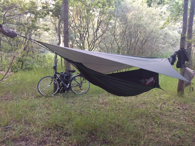
To minimise costs, I intended to spend as much time as possible camping wild in my slightly modified Hennessey Expedition Asym Zip hammock. Whilst technically illegal in some countries, nobody much cares if you are considerate and leave no trace of your visit. In fact, I would always try to find places nobody went, arrive late and be gone early. I identified quite a few threats which could affect my safety, or my ability to finish the tour. For instance: Ticks, mosquitoes, processionary caterpillars, snakes, wolves, javali (wild pigs), physical hazards in the forests, drowning in waterways, heavy traffic, unstable bike, poor or narrow road surface, steps, falls, dehydration, illness, hunger, navigation problems, mobile phone failure, theft and other attacks, punctures, bearing failure, broken chain, broken spokes or total wheel failure, hammock failure, sunburn, heat stroke, cold, skin abrasions, aggressive loose dogs, and/or loss of motivation. I also met other threats that I hadn't anticipated, such as bad mannered or dangerous riding from other cyclists, unexpected movements from pedestrians and dog walkers on the cycle tracks, roller bladers, and out of control three-year-olds on tiny bicycles.
The equipment I took was the hammock and a light sleeping bag, a couple of shirts and changes of underwear, waterproof jacket, cycling pullover and high visibility jacket, swimming trunks and towel, soap, toothbrush and toothpaste, spare jeans, some bike tools and spare brake pads, first aid kit, sleeping bag liner, insect repellant and insecticide, two mobile phones and charger, and a whole load of smaller items, most of which were carried in a single 35 litre Ortlieb waterproof roll-top bag strapped to the rear bike rack, or in a handlebar bag. On top of that I also took some roll matting for insulation, already trimmed to the size of the hammock, and equipped with velcro to keep it in place overnight. That kind of inline loading arrangement is good for steering, air resistance and dragging the bike through the forest, but leads to a high centre of mass, so stability can be tricky and the bike was very prone to falling over when parked. The bike also carried two cable locks, a small bag for carrying sun cream, handlebar compass, and lights, though I had no intention of cycling in the dark. Long ago I had thrown away the worthless resin pedals and replaced them with metal ones and adjusted the bearings, which always come too tight when you buy them. I had made up about a dozen emergency spokes with a z-bend at the end, so they can be inserted into the hub without removing the freewheel, as by far most often broken spokes are on the freewheel side of the rear wheel hub, just to get me to the nearest village or town in the case of major wheel failure out in the countryside or mountains. In the other handlebar I kept a plastic bag containing anything up to 100 euros, hoping that would fool any muggers, not that I expected any, despite one of my neighbours assuring me that I would be killed by bandits before getting out of Portugal. I had made a cylindrical bag with a drawstring at both ends, for carrying anything up to a two-litre bottle of water, tied and strapped onto the rear rack, and also strapped another two-litre bottle of Coca Cola onto the other side, for energy.
My party went OK, and having cleared up I soon realised that I was on the way to a cold, so delayed departure. There is no way I could have set out with a cold. So I suffered the cold and then set off on Saturday 6th May, feeling fairly rough but still hoping to make it to the Carcassonne area of France to join up with family and friends on the the Canal du Midi. But I already knew that this plan was much less likely to work now.
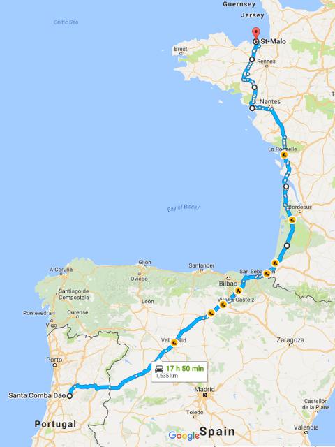
This will all make much more sense if you have a map to hand. Google Maps will show all the places I mention. I've included some photos and other images from Google Earth and elsewhere where I have them.
So, by days:
Day 1. Sat 6th May. Pregoinho to Matados. About 40 miles.
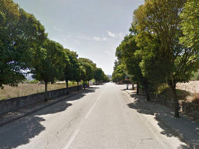
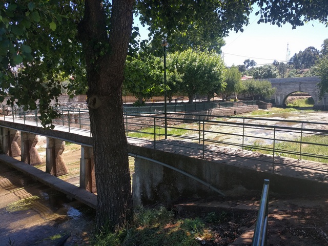
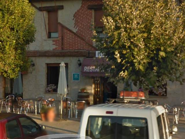
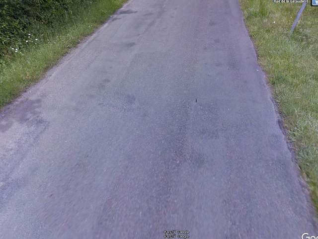
I set off just after mid-day from Pregoinho, down the tree-lined road into Santa Comba D�o...
...then down the steep hill towards the path to the steps down to the IP3, across the motorway bridge, 270 degrees right down more steps and back under the bridge towards Vimieiro. The steps were not easy on the bike, but very slowly I made it without breaking anything. Back on the road, this time I wasn't chased by dogs going up to the railway bridge in Vimieiro, past Salazar's birthplace, where entertainingly the plaque says "a man who governed... and didn't steal anything", and up to the N234 going east up the watershed between the D�o and Mondego, towards Spain. The sun was out, the temperature good, and I headed northeast through Carregal do Sal, Nelas and Mangualde. Navigation was easy but there were long stretches of teeth-jarring cobbles... probably the N17 would have been a better choice. Generally the elevation was increasing slowly. At Mangualde I joined the N16 east, and it became rather more hilly, but nothing major yet. I found a fairly large and quiet forested area to the north of the N16 and stayed there the first night, just past Matados and Outeirinho, suffering quite badly from general aches and pains and the remnants of my cold, but also in particular from quite bad cramps just about anywhere. Unpleasant. Other than someone testing a motorbike up on the main road it was a very peaceful night.
Day 2. Sun 7th May. Matados to Alvendre. About 30 miles.
Much more hilly! I was hoping to make it Arrifana, east of Guarda, on the second day, but progress was painfully slow and eventually I totally ran out of steam. This day got as close to killing me as any, as I knew it would. Staying on the N16 east, I crossed the A25, got slightly lost around Ch�s Tavares, went back under the A25, and followed the N16 up the Mondego, crossing the river at Fornos de Algodres. Once in the council district of Celorico da Beira, the road surface got much worse... and many more cobbles... I suppose they don't have so much spare cash to fix the roads up in the hills. Years ago, the Portuguese thought it would be a good idea to lay tarmac on some of the cobbled roads. This coating rapidly fell off, but gradually and in patches, making the surface worse than it had ever been, especially for cyclists. I found a nice small river beach in Lajeosa do Mondego, a small tributary of the Mondego.
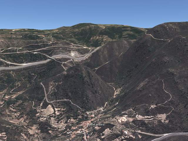
A better example of Portuguese bodgineering was the lighting on the beach... presumably having been broken, almost all of the lampshades had been replaced by inverted clear plastic water bottles taped on at the neck. The water was far too cold to swim or even to paddle, but I stopped for a brief rest and to rinse my feet. I had decided during the planning stages to go over the mountains at Porto da Carne via Sobral da Serra, which I had assumed would be on top of the mountains, rather than take the significantly longer N16 route south to Guarda. The N16 crosses the Mondego at Porto da Carne, which is at about 450m, then northeast to Sobral da Serra at 550m. Unfortunately, something I didn't realise despite using Google Earth, the road then goes steeply all the way up to the railway line at 750m, most of which is too steep to ride, even in first gear.
It was hot, hard work, with no tree shade, pushing the bike in the baking sun, with no respite even after the railway line, the road continuing to climb more gently towards 800m. So the total climb from the river was well over 1000 feet. Just short of Alvendre, where the M557 goes over the bridge over the slip road onto the IP5, I spotted the next climb with dread and no energy left, but at the same time saw a derelict-looking layby leading downwards to the left to a fairly steep area which didn't look farmed at all, with rocks and earth pushed about randomly, and two scruffy trees either side of the path at the end of it, one covered in brambles. But they would have to do, as I was out of energy. Once again, when in my hammock, bad cramp got me, the sort of cramp when trying to relieve one body part sets it off in another. Mainly hands and legs, but also back and stomach. Cramped hands are not so much painful as useless (though they are painful too), because however hard you try, you cannot let go of anything, which is very frustrating if you are doing anything. It took me nearly half an hour to get both boots off. The next morning I was just finishing packing up the kit when a small old car rolled in, containing the farmer. He was a very nice fellow and told me he'd seen something the previous evening from his animal huts in the valley below on the other side of the IP5, but had decided to leave it until the morning, and then come up to see if anyone needed help. I told him he had good eyesight, because I can't have been very visible from way down there.
Day 3. Mon 8th May. Alvendre to Ciudad Rodrigo. About 45 miles.
Better progress today. Up a bit and through Alvendre, then south, slightly downhill into Guarda Gare. One of the reasons for coming over the mountains was to avoid having to go up into Guarda itself, which is equally high and has lots of steep cobbled streets. It is also very easy to get lost in, which I knew from driving through it. But I overshot the N16 by one roundabout, and before re-joining it, had a coffee in a café near the station, around which most of the roads are in woeful condition and crowded with traffic, then headed east again on better roads towards the border. Arrifana and Gon�alo Bocas are quiet little villages and I noticed groups of people walking west. All the cafés were full of them, and one of them shouted over and pointed that F�tima was the other way. They were pilgrims on their way to see the Pope, who was due for a visit. They still had a long way to go. Slightly cooler weather, nice for cycling, and the road in places excellent, especially where for some reason it's brand new near the pre-fabricated house manufacturing site east of P�nzio, but not where it's very rough shortly after that where it dives down under the A25 viaduct to cross the river Côa, then climbs back up into Castelo Bom.
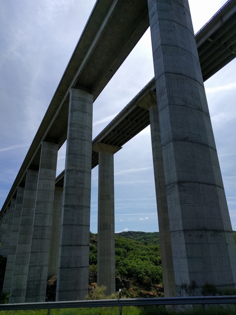
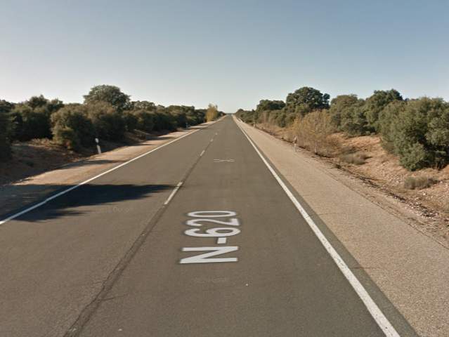
Road surface is critical to cyclists... it can completely alter the experience and can vary by the second. I've driven this route by car once or twice to avoid the tolls on the A25, so I knew it would be hard, and it was, but eventually I reached the border, and by accident, used my occasional rat run around the backstreets and over the railway bridge, which you aren't really supposed to do... but as (apart from a few police cars) there's generally nobody at the border post anyway it probably doesn't matter. I think Vilar Formoso is largely Portuguese, even on the Spanish side. Everyone in the supermarket was speaking Portuguese, and the Portuguese drive out there to fill up with petrol, because it's even cheaper in Spain than Portugal. I visited a lot of supermarkets during the tour, on average maybe two a day, because I couldn't carry much food at a time. Once on the N-620 in Spain, the road descends a little and is fast, which is just as well because it was quite busy for a mile or two, taking all the international traffic until the start of the A-62 motorway. There I had to turn off the main road to remain on the N-620 (or avoid the A-62), on the old road towards Salamanca. The best thing about Spanish motorways is that when they built them, they were not allowed simply to upgrade the old road... they had to build a brand new motorway beside the old road, which in the case of the N-620 is an excellent, well maintained, national class road...
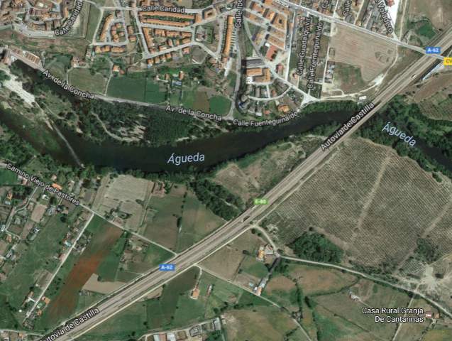
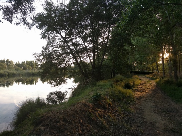
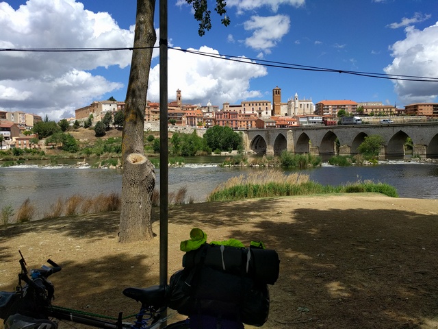
...better than almost all roads in the UK, often laser-straight to the horizon, with wide hard shoulders, and almost zero traffic. You might see one car or truck every ten minutes. The traffic was so light that it was possible to spend most time trying to cycle on the continous paint lines about two metres from the side of the road, to reduce road friction even further. With a light wind behind, I finally began to cover some miles, through the occasional village but mostly on the open empty road, towards Ciudad Rodrigo. The countryside changed in Spain to much flatter farming land, almost entirely crops. At Carpio de Azaba I stopped for lunch and a Welshman on a yellow motorbike stopped and asked if I knew where he could get petrol. There was one of those small derelict towers, about 2m square and 5m high, with sloping roofs, that you see all over Spain. They often have what looks like electrical connections near the top of the tallest wall, so they may once have been for power or communications, and the storks like to nest on them. I also noticed that all but the largest arroyos were completely dry, and those that weren't were fairly muddy and full of noisy frogs, limiting chances to keep clean out on the road, and I was by now developing a few saddle sores. My research had suggested good camping possibilities to the west of the river �gueda in Ciudad Rodrigo, but when I got there all the small forests seemed to be securely fenced in, unlike in Portugal. I spent well over an hour walking out into the countryside and back, looking without success for a decent place to stay. So having failed, I decided to cross the river and maybe find a hotel in the town... but then I soon noticed a very nice wooded area to the north of the river, which had a few picnic tables and some people there until it got dark, but after that I could hang the hammock and had a good night, much less troubled by cramp.
Day 4. Tue 9th May. Ciudad Rodrigo to Pedrosillo el Ralo. About 70 miles.
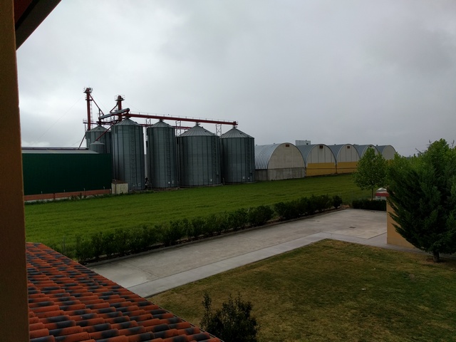
When I got up, I discovered the first of a series of mechanical problems, a broken spoke on the rear wheel, predictably on the freewheel side of the hub. This is because the rear wheel on a bike is dished to make space for the freewheel or cassette, so the tension in the freewheel side spokes is greater than on the other side, making them more likely to fail. I didn't carry full spokes with the proper nipples on the inner end, and getting the freewheel off would be messy and possibly difficult without a bench vice, so a visit to the local bike shop was needed. Also I had noticed the kevlar anti-puncture strip in the front tyre was starting to show through. There was a bike shop in the town, and I had to wait only about half an hour for it to open. I got a new spoke and new front tyre, and set off for Salamanca, wind behind. I think I lost only about an hour, made it through some nasty traffic and out the other side of Salamanca, which looks well worth a more leisurely visit some time, aiming for a camp site which for some reason I was sure was at La Orbada, a small village with a church (with some nice trees for hammocking outside it), a few houses, and seemingly no inhabitants. However, I had gone past the camp site... it wasn't at La Orbada. My Spanish is very weak now, but I managed to get from the only person I saw in the village that there was a site, Camping Olimpia, in Pedrosillo el Ralo, two villages and about 5 miles back up the road. Unfortunately, it was back into the teeth of quite a stiff wind, so took nearly an hour to get back there. The owner, Fernando, spoke good English and suggested the night would probably be horrendous with thunderstorms, also with the chance of rain tomorrow, so I elected to stay in a room rather than outside in the camp site. It did rain too, quite heavily. It gave me a good chance to get cleaned up, and charge all my electronics. Few cramps now. Nice place, not too expensive, pleasant owner, good food, and a rather bizarre view of some large and presumably agricultural silos next to the motorway, but I'd recommend it if anyone is passing that way.
Day 5. Wed 10th May. Pedrosillo el Ralo to Valladolid. 74 miles.
When I was clearing up my stuff to leave, I noticed a black dot in my bed, which I had been sitting on clothed the previous evening. The dot when poked turned out to be a smallish tick, about 2mm across. Ticks are one of the worst critters you can find near you, as even the very small ones can carry Lyme disease, which if not caught early can cause major neurological problems and be extremely resistant to treatment. The pathogen is similar to the one that causes syphilis. I know at least two people who have had Lyme, or have it now, and this is the prime reason I carried some permethrin and DEET with me to spray on my hammock and clothes, and a tick extraction tool. Nevertheless, this thing had somehow survived the night. It didn't have any blood in it though, and I couldn't find any bite on me, so I hoped I had been lucky. If you do get bitten, sometimes there is a bullseye type rash, and flu-like symptoms within the next two or three weeks, so I was on the lookout for them for the rest of the trip. 20 knots of tailwind today, so some good going, at many times over 20mph, not bad for a heavily laden bike. Back through rolling land past La Orbada, through Ca�izal, Alaejos, Siete Iglesias to Tordesillas. To the southwest, Tordesillas has some huge forests full of very impressive trees that would have made a good place to hang, but it was too early. Tordesillas is a very pretty place to have lunch (except for a dead sheep in the river).
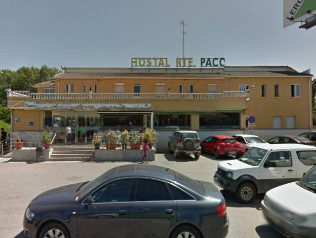
Then a road sign tried to send me out northwest, but I rejected it after a while, went back into the town via a big but empty industrial estate, then followed my planned shortcuts out via the back streets to the east, and most of the rest was on the canal path to Simancas. The canal was narrow, shallow and dry, not as expected from the map. No gradient, quite a rough surface at times, through some lovely farming country next to the Duero. It rained in Simancas, but not much. I crossed the river onto the old Simancas road from Valladolid and continued east through El Pich�n. Valladolid is big and scary, and very impressive, but has bike lanes and nobody cares if you ride on the pavements. The rain caught up with me just after another good decision to check into the Hostal Restaurante Paco between the A-62 and the Canal de Castilla just northeast of Valladolid. An even stronger favourable wind was forecast, so my intention was to try for the big camp site in Burgos tomorrow. The 74 miles or so today would easily have been more, but I had also got a bit lost in the sandy tracks around the back of the leafy El Montico urbanisation, and the slow towpath into Simancas didn't help much.
Day 6. Thu 11th May. Valladolid to Torquemada. About 40 miles.
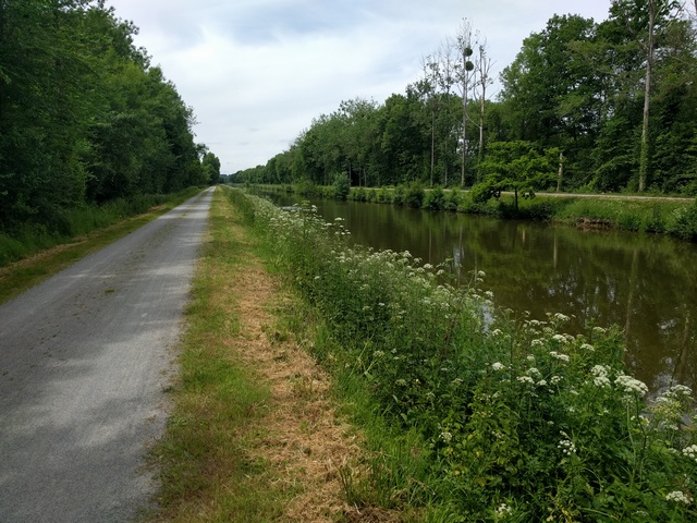
Today started out OK, some slightly tricky navigation onto the canal towpath, and a fair riding surface for the first hour or so towards Due�as. Now, the Canal de Castilla was full of water and much better looking. I knew from my research that Due�as would be difficult, and eventually ended up stuck at the end of an industrial estate. But eventually I worked my way around to the Due�as train station and under the A25, as rain threatened and occasionally fell. From Due�as, there is no obvious road to parallel the motorway, and there were a lot of thorny navigational issues to get up to Magaz de Pisuerga.
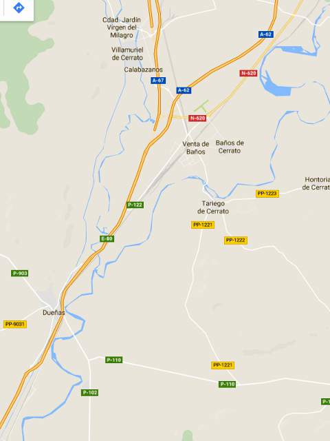
I had planned the diversion, but had to hide under a road bridge from another shower to revise it thoroughly. I had to drop south on the P-102, then east on the P-110 past the La Moraleja prison, then north on the PP-1221, crossing the river at Tariego de Cerrato, to get to Venta da Ba�os, all of which seems like a big detour but my research had found no other way. Once in Venta da Ba�os I could re-join the N-620 northeast. In Magaz de Pisuerga a road sign suggested the N-620 continued northeast, so unwisely I thought I would give it a chance, but in fact it tried to take me onto the A-62 motorway, not helpful at all, and not the only time that happened. So, some time wasted going back to my original planned route, which looked OK on the maps and satellite pictures, but turned out to be some very poor quality service tracks beside the motorway, with stones, tractor tyre ripples and potholes. Meanwhile, big thunderstorms were now gathering overhead, and I had to stop occasionally to avoid or simply suffer a shower, but thankfully not getting too wet. I did about 4 miles on the track alongside the north of the A-62, and used one farm track, heading for Torquemada, until it joined the beautiful smooth tarmac of the PP-4101 as it swings round towards junction 72.
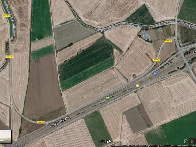
Then, ten seconds later, with a strange noise and a wobble, the left front wheel bearing collapsed and spat most of its balls onto the road, the bike becoming essentially uncontrollable. Luckily I wasn't going fast, but unluckily I was being closely chased by another thunderstorm which I could tell was going to give me heavy rain. The only option was to drag the loaded bike quickly across a ploughed field towards some big polythene agricultural tunnels next to the Canal de Alfonso XIII de Villalaco. The farmer's old dog barked at me initially, but he was a very mellow old thing, and we made friends just before the rain arrived. It hammered down while I hid in one of the polytunnels, wondering what to do next. The map suggested I was about 5 miles short of Torquemada, and I figured there ought to be a hotel there, and hopefully a bike shop tomorrow, but probably not today as it was getting fairly late. So if I could walk there, rain or not, I should be OK. When the rain stopped, I tried the bike again and realised that I could steer it a bit, and as the bearing failure would mean a new front wheel anyway, it was worth a try. The continuation of the rough service road direct to Torquemada up the A-62 didn't appeal any more, and I doubt I could have controlled the bike on a bad surface. Anyway, I was unsure that it connected fully through to the town, so I elected to go a longer distance north via the village of Villamediana, then back southeast to Torquemada. Very slowly. If the bearing had locked up it could have collapsed the whole wheel and/or put me over the handlebars, so it took a while. The failed bearing was screeching, and my worry was that the right hand ball race would also fail and make things worse, so I lubricated it with sun cream, which seemed to help. After a significant climb and descent, and some time, I made it into Torquemada, and by chance found a hotel, the Hostal Carazo. They told me that there was no bike shop in the town, the nearest being in Palencia. So I arranged to stay in the hotel overnight, and meanwhile Juan, a local at the bar, suggested I follow him round to his workshop, an enormous building with almost nothing in it. He spoke almost no English, and I speak almost no Spanish, but I already knew, and he very soon proved to himself, that trying to re-install the remaining balls into the bearing race was not going to work. However, he then reached up and as if by magic found a solitary washer on his shelf, the internal diameter matching the axle, and the external diameter more or less matching the bearing race in the hub. A bit of tightening and the bike was almost as good as new! But I knew it would not last more than a few kilometres at best, and, getting thoroughly sick of rough tracks, I resolved that rather than try to make it up the side of the motorway to Burgos, I would try to ride the thing to the bike shop in Palencia in the morning and then head north to Osorno and then east to Burgos via the main roads.
Day 7. Fri 12th May. Torquemada to Villanueva de Arga�o. 85 miles.
A long day, and again quite wet. Starting out with hoping the bodged bearing would hold out until Palencia, and amazingly it did, actually seeming somehow to get better as time went on. I headed back up to Villamediana, then through Valdeolmillos and Villalob�n. There was a joyfully large bike shop in Palencia, Deportes Manolo, with an English-speaking manager and a mechanic who fitted a new front wheel and new brakes all round. I wasn't helped much by the crosswind as I was now heading more or less north, and I was affected by yet more massive Iberian thunderstorms that made me stop and hide, first in Lidl in Palencia while buying and then eating breakfast...
...then under some scruffy bushes on the N-611 south of Amusco, then for a late lunch under the A-231 motorway bridge over the N-611 just south of Osorno.
The A-231 is easily my favourite motorway anywhere... clean, fast, empty, new, and free. A motorcyclist on a big Harley hid with me for a while. Then off east again on the N-120 via Melgar de Fernamental towards Burgos, one of the fastest stretches of the trip, with a good wind now more or less behind. However, I had spent a lot of time getting the bike to Palencia and then fixed, so eventually the increasing hilliness, threat of more big thunderstorms, approach of night and getting a bit cold all made me chicken out of the last 20 miles I had hoped for, to the camp site in Burgos. It was just as well I stopped in fact, even though it was yet another hotel costing me a fortune (especially as this one only had twin rooms), because the rain came down heavily outside just as I checked in, and it was dark quite soon. The weather forecast was better for tomorrow. I managed to get some of the local grog, Rioja, and celebrated being back on the road again.
Day 8. Sat 13th May. Villanueva de Arga�o to Armi�on. About 87 miles.
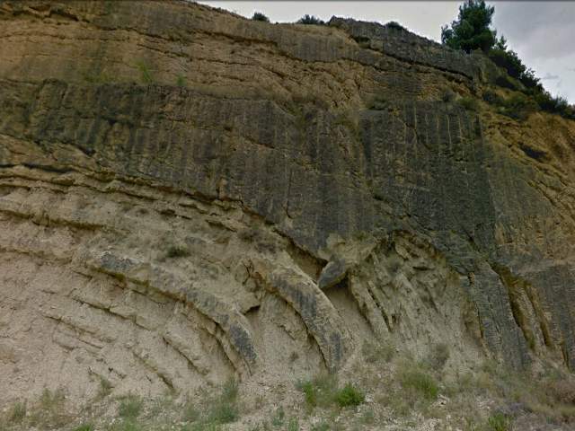
Into Burgos, which has some nice cycle tracks and is generally a nice looking city, and ignoring sensible navigation I just headed east through the trees near the river, so I ended up stuck on the wrong side of the river, heading up towards Carde�ajimeno, which then involved an extra climb over the hills back onto the N-120 going east. The traffic was light, and I find the Spanish generally to be good drivers and to go around bikes with good clearance, but I could have gone onto the Camino de Santiago next to the N-120 if it had been worse. There are loads of caminos de Santiago everywhere, all well-marked with the relevant symbol and all leading to Santiago de Compostela. (I even found some in northern France.) I assume that the one parallel to the N-120 had come from or via Logro�o. Good wind behind again, a steady climb into the forested hills towards Villafranca Montes de Oca, then a very fast dive onto the Rioja plains, generally downhill for many miles to Belorado, Santo Domingo de la Calzada, Casta�ares de Rioja and all the way to Haro. I achieved a top speed coming off the mountains of just over 40 mph, which looking back seems a bit reckless, especially as it maybe caused another broken spoke. You can see a good example of Spanish road-marking incompetence at Santo Domingo de la Calzada, where the N-120 bypass round the town suddenly turns into a motorway, the A-12. There are no warning signs on the N-120 to tell cyclists to get off the road, but luckily I noticed the change in road quality and a "no bikes" sign on a slip road leading up to it. So I had to go back into the the town centre by the LR-201, then out north on the LR-111 towards Casta�ares de Rioja, following one of the tributaries of the Ebro, slightly downhill. Haro is the capital of the Rioja region, with some interesting looking bodegas that might be worth a visit one day. Then, north up the Ebro, through a tunnel via a raised walkway, on the N-124 past Miranda de Ebro and heading for Vitoria-Gasteiz, though some very nice countryside, and despite the mountains all around, not too hilly following the river. There is some spectacular geology, as elsewhere in northeast Spain, with folded sedimentary rocks easily seen in cuttings blown out of the rock with explosives.
Just abeam Miranda de Ebro, once again the N-124 turns, without warning, into a motorway... the A-1 this time. Luckily I had predicted this and done some very detailed research how to get round the problem using the country lanes (more like farm tracks in some cases) in order to get past the A-1 onto the old section of the N-1 starting just north of Armi�on. It was odd passing the toll plaza on a farm track. Then left at a wooden signpost, across a couple of roundabouts onto the old N-1. The lowest numbered national road in Spain, in perfect condition, and no traffic, even more strange. Maybe I saw one car on it, and heard three during the night. I soon found a very secluded orchard next to the road, and settled for the night. I don't think anyone else had been there for months. I could hear a dog barking and the trains stopping at Manzanos station on the other side of the river, but nothing else, very nice.
Day 9. Sun 14th May. Armi�on to Vitoria-Gasteiz. About 15 miles.
An easy day, because I discovered the broken spoke probably from the dive off the mountains, and decided to stop off in Vitoria to get it fixed. The N-1 took me as far as the industrial estate at Nanclares de la Oca, then the road simply stopped. I knew it would, and unusually there are warnings from about 5km out. I had planned another set of detailed diversions to get me via farm tracks and service roads through Ari�ez and Gometxa into Vitoria. I also knew from Google Streetview that the N-102, in yet another fit of Spanish inscrutability, had been turned into a motorway without giving it an A- designation, so I had to parallel it on the A-4163 to the city. Being a Sunday, I had to wait until the next day for the shops, so it was a chance to check into a camp site (Camping Ibaia) and get cleaned up properly, and charge everything up fully. On the whole trip I discovered that often the two-star campsites are quieter, more interesting, and have more accessible and friendlier owners. The same can be said for municipal campsites, which are much better than I recall from years ago. It's not worth paying for four or five stars unless you really need beach volleyball, crazy golf, and you like a snooty manager. I can recommend Camping Ibaia, just west of Vitoria, about two miles from the bike shop as well as big Lidl and LeClerc supermarkets. I took the A-4163 into town to find the bike shop, and as again there were no signs I took the N-102 back... so I think I probably went on the motorway for a mile or so, but I didn't get stopped.
Day 10. Mon 15th May. Vitoria-Gasteiz to Zarautz. About 65 miles.
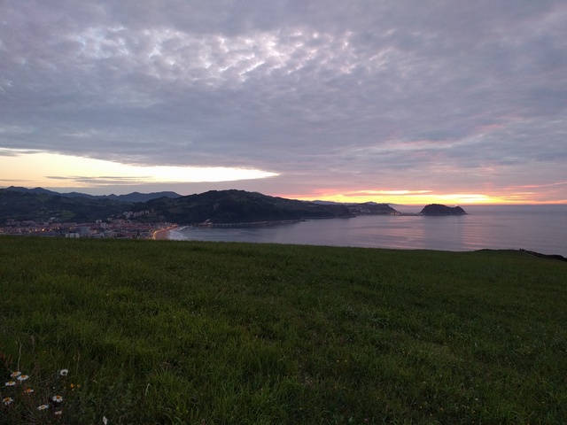
I went into Vitoria, to the third bike shop of the tour. New rear wheel spoke, freewheel side again of course, and I changed the rear tyre too, as it was getting a bit worn. The mechanic didn't speak much English but did enough to mention that he had done a cycle route called "La Vélodyssée" (aka "The Velodyssey") up the west coast of France. I knew there were cycle routes of course, but in view of them being more winding and with slower surfaces I hadn't really considered them. That would soon change. Vitoria is one of the most beautiful cities I have seen, thousands of trees, wide avenues, bike lanes everywhere, and according to the bike mechanic the "Green City of Europe". Hence the name of the shop, "Green City Cycles", I suppose. Perfect. And the weather had properly improved now. Also, in view of my bad experiences with motorway service tracks, I had decided to completely change the route, from going east to Altsasu and then north, to going north to the coast at Deba and then east along the coast. Following the small A-3002 out to the north, it turned out it is a cycle route, with lots of cyclists inexplicably saying good morning in Portuguese, past the tranquil Ullibarri-Gamboa reservoir, through Arrasate, Bergara and Elgoibar, following the River Deba down to the small town of Deba on the coast. Some of it was on unexpected cycle tracks, and all of it in beautiful mountainous countryside, but next to the river not at all hilly to cycle, and generally downhill of course, getting back my height investment of climbing up into Spain from Portugal. The Basque countryside is stunning, with mountains and forests all over. Luckily nothing went wrong, as I don't speak a word of Basque. However, it was initally very hilly going along the coast from Deba to Zumaia, then to the "Gran Camping" at Zarautz, which is a few hundred feet above sea level, another long climb not really wanted at the end of a long day. The price was reasonable but the manager was fairly miserable and even wanted to charge me for WiFi, and even 60 cents to charge my phone, it was far too crowded, and I'd not really recommend it.
Day 11. Tue 16th May. Zarautz to Hendaye. About 30 miles.
I was trying to get to France, where at least I understand the language better, even if I've forgotten how to speak it. Luckily, I figured I could turn east out of the camp site and go down to Orio rather than waste the height going back to Zarautz then have to climb out of the town again. Then up the N-634 towards San Sebasti�n, not too bad, until the road finished and became the GI-21, GI-20 and eventally GI-636 to Irun and Behobia, which was more than somewhat suicidal, with all the toll-avoiding traffic using it between France and Spain, so I decided to navigate by sun and compass for a while. Then, in San Sebasti�n, I suffered another spoke break coming off a pavement near the river. Generally the road surface was poor, but it normally is in cities. Luckily there was a bike shop just a quarter of a mile away and it didn't take long to fix. Except that the idiot mechanic failed to re-fit my spoke protector disc, something I didn't notice until I got to Hendaye. So it's amazing that I didn't write off the whole wheel, because the chain had previously been jumping off onto the spokes a few times. I put first gear out of bounds after that, which made control even worse going uphill in the heavy traffic. Owing to poor signposting, I missed the Irun bridge and crossed (with what started out as relief) into France at Behobia, then onto the D811 for Hendaye, with one eye out for La Vélodyssée. However, I didn't see any signs to it, and ended up in a 4-star camp site "Camping Ametza", which had nice people in the reception, and overall was quite good, except that the pool was shut. Things were getting much more expensive in France. Also, by this time the poor standard of French driving was convincing me that I really did need to check out La Vélodyssée. The thought of doing 800 miles mostly on French main roads was getting unappealing, and also my shoulder was starting to hurt. I would say that the transition from Spain into France was probably the least pleasant section of the tour.
Day 12. Wed 17th May. Hendaye to Tarnos. About 40 miles.
I'd done something to my right shoulder coming over the mountains from Spain into France, and this was starting to cause significant problems. But luckily the camp site reception told me that La Vélodyssée went almost right past the site, and as I soon found it was mostly flat, wide, smooth tarmac and empty, so I resolved to stay on it as much as possible and abandon the route I had planned, in broad detail, to Calais. This would mean that I could at least make progress while hopefully my shoulder recovered, and had much less chance of a road accident, but it also meant slower overall progress north. I'd already scrubbed the idea of going across to the Canal du Midi to meet family on holiday, due to lack of time, but my shoulder was now making a complete scrub and a bail out at Bordeaux or even before quite possible. Essentially, in normal riding position, within a few seconds tingling would go from my fingers almost up to my shoulder, then the pain would start, and then all strength in the arm would go, so I would have to let go. The only way to ride was sitting up vertically and using my left arm, the right held limp or behind me like a winged swan, and even that wasn't perfect. Not only that, it now became extremely hard on the backside, especially on rough roads, and rather more saddle sores were caused. However, reasonable progress was made, via a partly coastal route, through the holiday villages of southwest France. Sand and pine trees everywhere, ideal for hammocking, but in view of my medical state and the generally damp weather I decided to go into another camp site later. Next I went through Bayonne, where, due to poor but fortunate signposting, I found myself at the big Ametzondo shopping centre, where they had free WiFi, and it was a very good place to hide from the rain and do some planning. Eventually, a few miles up the D810, I found a camp site in Tarnos, just into Les Landes, Camping Jobel, a slightly odd but fairly pleasant 3-star family camp site, outside which I managed to fall off my bike going up a badly-laid dropped kerb. However, it was my carelessness, and luckily I only grazed a knee. Better still, nobody saw me do it.
Day 13. Thu 18th May. Rest day in Tarnos. 0 miles.
The weather was very wet, but at least I could get cleaned up properly. I walked down to the Carrefour supermarket in Tarnos. On the way I stopped in a café for some WiFi and coffee, and after some false starts in French and Spanish discovered that the girl behind the bar was Portuguese... quite a relief at last to be able to have a conversation where we both understood each other reasonably well. When it wasn't raining, I tinkered with the bike, adjusting the derailleur stop so I could confidently use first gear again without much risk to the spokes, and re-tensioning the rear spokes. I discovered some that were incredibly tight... it's a fairly new wheel so I assume that the mechanics in Spain had no idea of how to tighten them properly. They were so tight that it was amazing that no more had broken. I took a quarter to half turn out of each spoke adjuster and then re-aligned the wheel, tapping each spoke to hear the pitch until the tension in each was more reasonable. From then on, I had no more broken spokes. You would expect mechanics in bike shops to be able to do that correctly, but apparently not, as well as losing bits of my bike. I am unimpressed. Nice to have a day off, even if wet.
Day 14. Fri 19th May. Tarnos to St. Julien en Born. 50 miles.
All on excellent wide tarmac cycle tracks, through the amazing pine forests of Les Landes.
Capbreton is a very nice seaside resort, though probably riddled with tourists in summer. Good signposting, and very little time off La Vélodyssée. Just a couple of miles inland, flat and relatively fast, though my shoulder was probably costing me 25% of my speed, and still hurt quite badly. I thought I could make it to Bordeaux and fly or train out if necessary. I ended up at the municipal camp site "La Passerelle" in St. Julien en Born, and met Dave, a retired fireman from Hampshire who had moved to Alicante, who helped me find Didier the very helpful manager when he drove round, made me a hot drink, and told me lots about Maddie McCann. So, a good day except for the shoulder, an entertaining evening, and a recommended stop.
Day 15. Sat 20th May. St. Julien en Born to Sanguinet. About 50 miles.
Fireman Dave had gone before I got out of my hammock to grab a morning coffee from him. Another reasonable day, still with major shoulder problems, but most of it on La Vélodyssée up through Les Landes towards Mimizan, Parentis-en-Born and Sanguinet. Today and yesterday had reminded me powerfully of driving through the same area a couple of years ago with a failing clutch thrust bearing, that eventually almost completely failed somewhere near Poitiers and made me drive 500 miles with an almost completely useless clutch pedal. Not very easy starting the car, nor changing gear. One day I will be in the area with no mechanical or physical problems, I hope. In Sanguinet it began to rain again, and I hid under the awning of the tourist information centre, to meet up with another cyclist, Loic (a Breton name), only cycling locally, who told me that Napoleon III had planted all the pine trees to dry out the sandy dunes and swamps and to get the resin and wood for various uses. So, like the eucalyptus in Portugal, the pines are not native. Towards the end of the day I came off La Vélodyssée to take a main road shortcut up the D46, and the traffic was acceptable, until I found a small forest by the side of the road between Sanguinet and Mios. Perfect location, very near the main road and easy to get to via a dry ditch. However, in the dead of night, about 2:30am, something came close, yelping periodically. I thought it might have been a fox, but others think it could have been a muntjac deer. Either way, it gave me the heebie-jeebies a bit, especially when, for one bark, it came very close. But I was downwind of it, so it probably had no idea I was there. Needless to say I had few weapons, and planned to try to scare it off with my mobile phone LED light if it came sniffing around. But it eventually went away and the rest of the night was quiet. I heard the same type of animal a few days later in a similar forest, but not nearly so close.
Day 16. Sun 21st May. Sanguinet to Hourtin Plage. About 60 miles.
Again, flat going through Les Landes, north of Bordeaux now, so more or less putting that bailout option out of reach, shoulder no better but I figured I could put up with it for a bit longer. Steady going in warm dry weather, ending up at a 5-star campsite that really didn't deserve more than three stars in my view. Dirty toilet block, with birds nesting there, and a monstrous 25 euros to pitch a hammock, sandy ground useless for tent pegs, completely outrageous, but all that I could find. I nearly walked off into the forest, but I had low batteries as my backup charger seemed to have failed and gone flat, and I needed a decent scrub, so I put up with it. Camping de la Côte d'Argent, not recommended by me at all. Tourist prices.
Day 17. Mon 22nd May. Hourtin Plage to Royan. 40 miles.
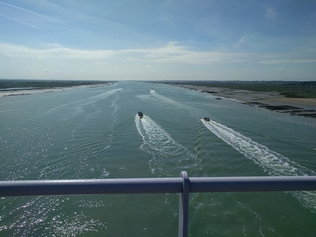
Another day on largely empty cycle tracks, keeping close to the coast, mostly flat except when following the old railway line over from Soulac-sur-Mer to Le Verdon-sur-Mer on the tip of the peninsula on the south side of the Gironde Estuary. Then after a short wait I crossed the estuary on the boat from Le Verdon (5 euros) to Royan and then followed left up the coast to the Forêt Domaniale de Saint-Augustin-les-Mathes, with La Vélodyssée never more than a hundred metres from the beach, and plenty of opportunities for a camp site in the pine trees on the dunes. A few derelict concrete bunkers from the Second World War to spoil the view of a glassy green sea out in the Bay of Biscay.
I finally got round to rolling back the left handlebar horn and moving the wing mirror stalk so that I could ride more comfortably upright with one hand, which did help a bit, but didn't help the backside. Unfortunately, at the same time, the quality of the cycle tracks took a bit of a dive north of the Gironde, and the signposting became quite unreliable.
Day 18. Tue 23rd May. Royan to La Rochelle. 70 miles.
Passing through the Forêt Domaniale de la Coubre de Tremblade on La Vélodyssée and especially thereafter, it became quite easy to get lost. However, the weather was good and some of the sights more than made up for the navigation problems, like the D728E bridge over the river Seudre southwest of Marennes. There is an astonishingly complex system of salt marshes inland of the bridge. A dozen amazingly fast flat bottomed boats were coming in from the sea, carrying I know not what, but the whole coast from then on up a long way seems to be devoted to oysters and mussels. They were as quick as speedboats, racing each other in, possibly 30 knots or faster.
After Marennes, there is a good example of how the French sometimes repair the roads seemingly with a paintbrush... very thin layers of tarmac applied over one another, giving the road a kind of transparent appearance, or maybe a late Mondriaan.
There is a kilometer or so of gritty farm track from here, where someone was repairing a puncture, to Le Grand Breuil, then La Vélodyssée meanders over the freshwater wetlands south of Rochefort between Hiers-Brouage and Saint-Agnant, and here I saw a coypu, that seemed entirely unconcerned about me, swimming in a ditch. I stuck to La Vélodyssée as well as I could, with frequent navigation stops, and somehow ended up getting through Rochefort. I then followed the coast up through Yves and Les Boucholeurs on the coastal track. Oyster and mussel tasting places everywhere, and some tiny piers each with a hut on the seaward end and a large suspended net, maybe some delivery system from boat to land. Then up to La Rochelle. Another cyclist (Philippe, I had to stop myself asking him if his surname was Phelope) helped me over the last few kilometres into La Rochelle to find the supermarket. However, his instructions for a camp site didn't work well. I finally found the municipal site "Le Soleil", but it was closed, until the 24th, the next day. But not secure... I could just walk round the barrier, and I thought that they really should have been open by May (after all, many others are), so I stayed there anyway. The entire 200-pitch camp site to myself, with no facilities, in the middle of a bustling city, right next to one of the biggest marinas in France, at the end of May. Bizarre. But I thought I would leave early to avoid the possible grilling and general Gallic disapproval when they came to open up for the season.
Day 19. Wed 24th May. La Rochelle to Les Sables d'Olonne. 76 miles.
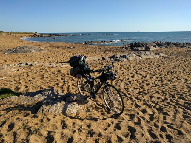
North/west early out of La Rochelle, avoiding the rush hour and going around the famous docks, reminding me of the submarine pens in the great Wolfgang Petersen film "Das Boot" (if you've not seen it you should, and it's better in the original German, with subtitles). Getting out of the city was a real nightmare, because although it was signposted and I am fairly certain that I was on the correct route west, eventually the signposts stopped, and it was completely unclear how to go on. Most of the signs pointed towards the Île de Ré bridge, and at one point I had to back up a motorway slip road, yet again, just like in Spain. I navigated more or less by the sun through the Les Rivauds industrial area to the south of the airport, and entirely by luck spotted another cycle route sign leading up onto the cliff path going north. Then it was fairly easy going across the flat farmlands towards Esnandes, Charron (where I got slightly lost going west into Les Groies), Puyravault, all of these places very maritime, then west to Triaize, Grues and Angles, where I stopped for a coffee. The wiry-looking chef in the café saw me lining up for more cold water for my flask and asked where I was going. I don't think I managed to tell him I'd come from Portugal, but as soon as I said I was heading for England his expression changed to one of either respect or pity, and he shook my hand firmly and wished me a good trip, then started telling everyone, so I made a reasonably quick exit onwards to Longueville-sur-Mer, Jard-sur-Mer, Talmont-Saint-Hilaire, and Les Sables d'Olonne. Les Sables d'Olonne is basically a gritty machine for relieving tourists of their money, with plenty of camp sites with many stars and lots of visitors, and with a flashy brochure, but with no useful advice whatsoever from their tourist centre about anything more modest. In fact, their town maps show the tourist information centre in the wrong place, which isn't at all helpful, so I wasted a good hour or two until I finally gave up with them, and went out the other side of the town to eventually successfully find a couple of trees near the beach, in the forests heading out towards Brem-sur-Mer. Nice peaceful wild camp, and I even managed to get a swim in the sea. A hot and long day, and by now I was suffering a bit from sunburnt legs and nose, despite cream, and my shoulder was not much better.
Day 20. Thu 25th May. Les Sables d'Olonne to Notre-Dame-de-Monts. 40 miles.
Very hot again today. I picked up some chain lubricant in Brem-sur-Mer. Because of the heat, I only did 40 miles before swinging in early to the municipal camp site L'Orgatte in Notre-Dame-de-Monts, very friendly staff who were happy to re-charge my phone charger via USB, and a quiet location about 300m from the beach, with direct access via a sandy track, so another swim, though there were a lot more people about and at high tide almost hard to find a place on the beach. I had time to do a full set of laundry, such little clothing as I took, and to visit the town in the evening for a couple of beers and some WiFi at a very strange café that seemed to sell nothing at all, and was practically empty. I don't know how it survived. On this day I passed 1,000 miles from the start in Portugal.
Day 21. Fri 26th May. Notre-Dame-de-Monts to Saint-Joachim. 58 miles.
La Vélodyssée goes inland to Nantes and back out again, and I was wondering why. So I set off north via Bourgneuf-em-Retz, where I stopped for a coffee, and then Pornic, towards Saint-Nazaire, hoping to make it to the Parc Naturel de Bri�re, which I assumed would be a forest of some sort. A hot day yet again today. The D213 leading up to Saint-Nazaire is the "Blue Route" and I soon discovered that despite the D and three digits, it is almost a motorway. I could legally use it, but I didn't like it much at all and came off it as soon as possible through Saint-Brevin, which is very nice, and looks very expensive. There was someone on the beach selling the most amazing collection of kites, of which he had about a hundred in the air at once. Then I found out that that the reason La Vélodyssée goes inland is surely the Saint-Nazaire bridge. It has a signposted bike lane leading onto it, but the so-called bike lane over the bridge itself is really narrow, and the footpath even narrower and raised, so that pushing a bike along it, even unloaded, would be suicidal. There are three vehicle lanes on it, two going one way and one the other, carrying the traffic of the "Blue Route" that I'd come to hate. Luckily there is a 70kph speed limit. The bridge is steep at both ends, goes up a couple of hundred feet to the middle, so the lowest gear is needed. So, control is difficult at the best of times, but for me, with only one working arm, it was almost, but not quite, impossible. Painful as well. The gusts from passing lorries and wind and thermals from being 200 feet over an estuary a few miles from the open ocean did not help at all, but somehow I made it to the top alive and raced the lorries down the other side. On the Saint-Nazaire side, despite previous meticulous planning, I got a bit lost and ended up going east along the wrong road next to the Airbus hangar area at the airport, but eventually I made my way back onto the D50 heading north, via Montoir-de-Bretagne and its Super U supermarket, and meeting up again with La Vélodyssée that most sensible people would have taken via Nantes. Unfortunately, the Parc Naturel de Bri�re is a wetland, not a forest, so there were few trees, and many cycle paths, not all well signed. Beyond Saint-Joachim, there was a rusty chain across a path leading to a small oak grove and water-filled channel, which, other than the mosquitoes, made a very good and private camp site, just 30 metres from the main road. There was some drumming and music coming from a nearby house until late, but not too loud and no problem. Planning for the next day, I determined that I would be better going back into Saint-Joachim and heading northeast to Crossac, Pontchâteau, Drefféac, Saint-Gildas-des-Bois, Fégréac, and Redon, to join the great Nantes-Brest canal.
Day 22. Sat 27th May. Saint-Joachim to Plo�rmel. 66 miles.
A really good day, quiet country roads all the way to Redon, a relaxed coffee near the railway line in Redon, then slightly gritty towpaths minimising top speed, but I was getting a little more use out of my right arm by now, and the canals were straight, flat, and long.
Being a Saturday there were lots of people coming the other way, not all well-disciplined, and I reckon my "bonjours" had now passed the five hundred mark since getting into France. Navigation was easy along the canal and the river Oust, then at Malestroit I left La Vélodyssée for the final time and joined the Rhuys to Saint-Malo "Route 3" heading north towards Plo�rmel, mostly following a disused railway line through the legendary Forest of Brocéliande, main focus of Brittany's Arthurian legends, and Plo�rmel, a favourite home of the medieval dukes of Brittany. Long but fairly easy day, no major problems and some great scenery. In Plo�rmel, I went round the west of the big freshwater Lac au Duc to a family run 2-star Camping du Lac, which turned out to be a great find.
Day 23. Sun 28th May. Rest day in Plo�rmel. 0 miles.
Day scrubbed due to rain. I went into Plo�rmel to find an open supermarket or shop, but I think they only open (if at all) until about mid-day on a Sunday, and I had missed them. In fact the whole place was essentially shut, except one restaurant uselessly without WiFi, and one already full. It had turned too cold for a swim in the lake. During the spectacular thunderstorm that evening, with thunder crashing overhead and the rain sluicing off my hammock, the owner came out and offered me a chalet for the night, but I said I'd be fine. I would probably have got wetter moving to the chalet than staying put in the hammock, which essentially remained dry except for some spray on one side. But I could tell that he didn't really believe I would be OK. I will certainly call by there again if I can... nice location, lake next door and helpful owners.
Day 24. Mon 29th May. Plo�rmel to Taden. About 50 miles.
Back onto the cycle track to Mauron and the fairly quiet D766/D166 through Ga�l (where due to roadworks and poor signposting I ended up briefly going more or less backwards up the route), Saint-Méen-le-Grand, Caulnes, generally fast on improving (but also busier) roads, generally slightly downhill, and with a slight tailwind, until Le Hinglé, a peculiar village seemingly with all the houses built out of the same type of stone, where the weather got quite a bit worse and the road seemed much more crowded, so I decided to head down the old Roman road straight to Dinan. Navigation became quite tricky for some reason and Le Hinglé seems to be built on not one but a series of short steep hills. They continue more or less all the way to Dinan, which is ridiculously hilly for anyone to ever think of building a town there. However, it does have a steep river gorge on the river Rance, and many boats moor there, including a fair number of English-registered ones. I quite often heard English. Unfortunately, the municipal camp site was shut, I could get in, but this time there were no suitable trees to hang from. A German couple in a motorhome had the same problem, and they couldn't even get past the barrier, so we worked out how to find the next site, about 4 miles up the road in Taden. Another couple of nasty climbs later I got there (La Hallerais, actually another municipal camp site owned by the municipality of Taden), but reception was shut, and there was no shop, and only one free emplacement with a single tree and a concrete fence post to hang from. Hopeless for a 4-star site, how they get that many stars is beyond me. At least the sanitation block was quite good, except for the water being a couple of degrees too hot. The sign outside pointed to a bar "200 metres" away (actually it was a good 600 metres) in the village with two or three miserable looking locals and a fairly miserable looking owner, but at least it had WiFi, so without looking I had a couple of beers there while planning the next day. Thirteen euros! For two half-litre beers! Ridiculous, even though it was rather nice beer. No food there either... all I could get was peanuts, a few sad peanuts poured from a bag into a saucer. No wonder they looked glum, I doubt anyone ever goes back there twice. I won't. And I probably won't go back to that camp site either, even though the receptionists were good the next day.
Day 25. Tue 30th May. Taden to St. Malo. About 20 miles.
No crashing rush to get going, so I paid up and had quite a long chat with an English woman, Cathy (I think), who was keen on cycling. Then I went back to the Route 3, easy to find almost from the camp site gate all the way down to Dinard. Mostly an old railway line again, straight, largely tarmac or some other decent surface, with only a bit of sand and leaf mould towards Dinard. Fast and nice going through railway cuttings under grey skies which threated to rain, and did, but only for about two minutes, then it started brightening up. I got a bit lost (again) in Dinard and then had to wait for an hour for the ferry to cross to St. Malo. The captain's lunch break. That was another ripoff - over 9 euros for a ten-minute trip. The Gironde ferry was only 5 euros, for a boat 5 times the size and for 3 times the distance. But it was too late to argue or go back round by bike. Once on the St. Malo side I had a good couple of hours to re-pack bags etc., ready for getting on the boat, my intention being only to carry my handlebar bag and some food.
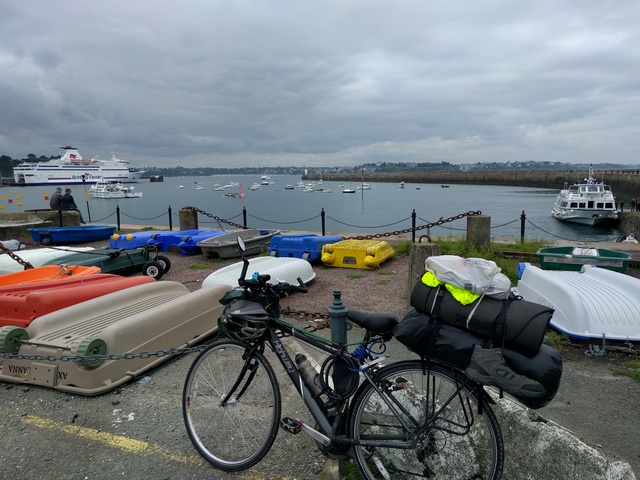
Free WiFi in the port was useful, then eventually they let us on the boat, which was almost empty. I'd booked a lounge seat for an extra fiver, but it wasn't worth it as there were hundreds of free seats.
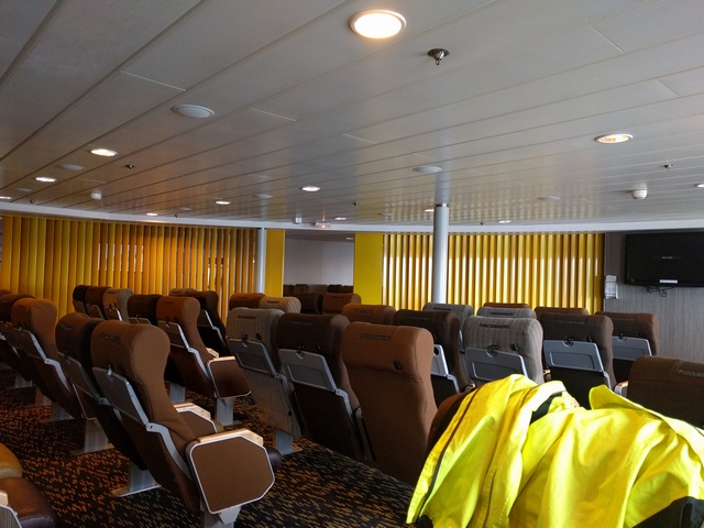
Also, they'd put a French guy in the next seat, which seemed a little mechanical... you'd think they'd have the sense to spread people about a bit. Anyway, I went into the next lounge, which for most of the trip I had to myself. There was free WiFi on the boat also, but via the ship's satellite link, so a bit slow at times, too slow to download offline cycle maps of the UK. I have now bought "Komoot", which seems very good for planning cycling and hiking tours, lots of features and only twenty euros for lifetime updates to a selection of types of map worldwide. I won't be planning any future bike rides without it. A fairly bad night's sleep on the boat, largely because I got a bit cold and woke up to move back into the original lounge which was warmer, but I did get some sleep. The boat roared off out of the harbour, then cut the power almost to idle and slowed down below ten knots for the entire journey to Portsmouth. The sea was almost flat, and the boat apparently motionless. Easy crossing, very quiet, and very boring for the captain I should think.
Day 26. Wed 31st May. Portsmouth to Gosfield. 0 miles.
Thankfully, I had very kindly been offered a lift home. I hadn't made any plans for how to get from Portsmouth, and such research as I did manage to do on the boat suggested that I could probably have done it via cycle routes, but that would put me somewhere near central London overnight, unless I took three days to go round. I didn't fancy camping anywhere near London without much more research, so the lift was greatly appreciated (thanks Chris!), and we arrived in Gosfield in time for us to have lunch in the pub at the end of the road.
===
And that was it. As before, it took, and will continue to take, some time to get over it, mentally and physically. These are just some memories. I have others that I can't reliably place on the map, so I have left them out, but what I have written here is I hope fairly accurate. It's not possible to reproduce the exact route I took on a map because of the large number of waypoints, and small paths used. Besides which, I can't remember all of it and was occasionally slightly lost anyway.
Having written it up, I ask myself what I would change next time. If I do anything similar, it probably will not be such a long trip, this time having been somewhere around 1275 miles, though it is hard to tell exactly as occasionally I forgot to get my bike computer running for a short while when it had switched itself off after 10 minutes or so of inactivity. Maybe it was over 1300 miles, maybe as much as 1400, I don't know.
Obviously it was a little disappointing to have to come out of France at St. Malo rather than Calais, and not to do anything in England, but even as I write this my right shoulder is causing problems (mouse usage is also a difficult position), though it is getting slowly better. The first time it flared up (probably caused by loading heavy stuff into my car) it took a good six months to get almost fully better, so I think I made the right decision. Considering that I was thinking about aborting the trip before Bordeaux, I think I can be satisfied, and it was technically a ride from Portugal to the UK. I wouldn't have considered going through Santander as counting for that, but through northern France, yes. Perhaps I will do the St. Malo to Calais section some time soon, for a holiday. I've been very favourably impressed with the cycle tracks in France, as much as I have been unfavourably impressed with some of the French drivers. It's not all of them... like anywhere, those that own bikes will wait behind and give you maximum clearance, using the whole oncoming lane if it is free, but the ignorant will come close and try to squeeze through gaps, assuming that just missing you is acceptable. It's the same in the UK, though marginally less so.
So, planning another tour in the UK or France, and bearing in mind the increase in vehicle traffic and improvements to the cycle network, I think I would start by planning to use the cycle routes as much as possible rather than necessarily go in a straight line. Spain is much less of a problem because the roads are much quieter. Portugal is generally OK because the national roads are smaller, slower, and generally have wide edges. Main roads, even 3-digit ones, are generally worst in the UK and France, in my experience. And the drivers.
As far as equipment and clothing is concerned, I more or less got it right. The hammock was perfect, and performed well even in heavy rain. I would probably not take long trousers, and would maybe leave the sleeping bag liner behind, both quite bulky. Some other things I didn't use, like the First Aid kit, but I would have to take them anyway for emergencies. I would take a small dedicated camera, because there were many things I wanted to photograph, but each time required a full boot-up of my phone, not realistic, especially with a low battery. The low battery was caused by the type and age of the phone and also the apparent failure of the solar panel on my phone charger pack to actually work... I need to test it thoroughly before relying on it again. I would probably spend more time making sure the bike was in good condition. I would check the wheels and tyres more thoroughly and fully service the gears and brakes. I should not have ignored the occasional clicking sound from the handlebars that I am now sure was the early stages of bearing failure, and I paid for that mistake. The strap system I devised for the roll-top bag I carried worked well, but the bag itself is now essentially ruined, so I might take panniers instead, but probably only on the rear rack. The handlebar bag performed very well, and I would certainly use that again.
I would probably aim to do slightly less mileage per day, and have a better idea of where I might end up. Wild camping is fun and it is generally fairly easy to find a quiet place to camp, but it is noticeably more difficult to keep clean, and in view of the improvements in camp site standards, I would probably aim to end up in one at least every second night, which when my shoulder went bad is more or less what I did. Two-star camp sites are fine and generally more friendly, but they are less likely to have facilities for food and drink, so it would be worth knowing where the local shops are and what times they are open, rather than relying on luck.
Motivation wasn't a problem. Maybe it's me, but I wasn't tempted to give up except perhaps briefly when my arm had become a problem. In fact, the pain wasn't the main issue, but the lack of control was. At best, a fully laden bike with a high centre of mass is less easy to control anyway, but with one arm, maybe uphill into a gusty wind, with lorries and buses coming past, on a poor road surface in drizzle, the risk becomes unacceptable. If it was not for La Vélodyssée, I would certainly have had to abort the tour before Bordeaux. Being out there on my own was fine, everyone was friendly, and I never felt threatened by any (unmotorised) person. The language problems were occasionally significant. I thought I would remember my French again as soon as I got into France, but that didn't happen much... I will need to revise it thoroughly before trying to use it again.
It took me a couple of full days to plan the trip, 26 days to do it, a few hundred euros in expenses, and about three days to write these twelve thousand plus words and organise some pictures. To give an idea of how long the tour was, I rode about one mile for every ten words of this writeup. (So this ten word sentence would be yet another mile.) If anyone who has not yet donated to my charities feels that any of my efforts are worth a few quid to charity, then please go to http://uk.virginmoneygiving.com/fundraiser-web/fundraiser/showFundraiserProfilePage.action?userUrl=AndySanderson or search for me on Virgin Money Giving, or you can hand me cash and I'll pass it on. I am supporting Cancer Research UK, Parkinson's UK, Essex and Herts Air Ambulance, Sustrans and the Alzheimer's Society.
It would be nice to reach my target, or at least get nearer to it. Many thanks!
A.